Where does the water go?
Have you ever dropped a stick in a river and wondered where it might go?
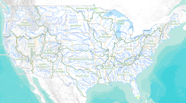
For those among us either hydrologically and/or geomorphologically challenged, the new US National Atlas presents “Streamer”, another excellent instalment in “Gov 2.0” initiatives.
The work of policy-makers, planners, geographers and geographic information experts to visualise the complex inter-relationships between drainage basins, communities and entire nation-wide catchments is another positive step forward for near-real-time evidence based planning so critical to sound, long-term planning.
This is a new interactive web map that allows you to explore America’s streams by tracing upstream to their source or downstream to where they empty. Users can learn more about stream traces and the places they pass through in brief or detailed reports.
Murray-Darling?
Links
- The US National Atlas – Streamer
- US National Atlas
- Gov 2.0 – Wikipedia
- Australian Government 2.0 Task-force 2010
- Response to Government 2.0 report [ May 2010]

Where does the water go? An excellent contribution to Gov Data visualisation – US National Streamer Map http://t.co/F2N5DqTRE2…